Getting to the bottom of glacier lake – KU research boat on its first mission

[Translate to Englisch:] Forschungsboot
© Christian Klenk

On land, in the air – and now also by water: KU Geographers are broadening the scope of their research. Their equipment now includes a research boat with a high-precision depth sounder. It allows researchers to survey the bottom of lakes, rivers, and the sea. This technology has now been used for the first time in a research project in Kaunertal, Austria, where KU scientists have been studying the effects of climate change for several years.

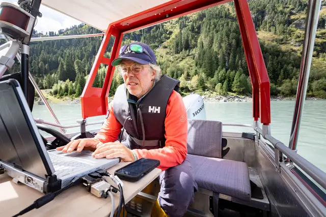
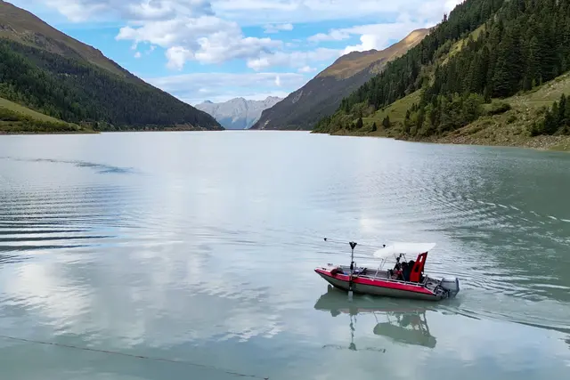
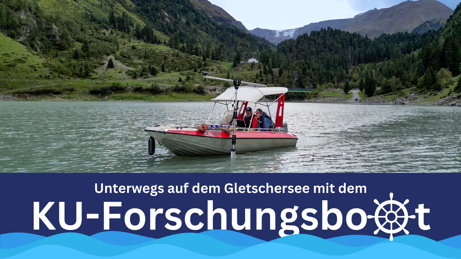
Dr. Florian Haas, adjunct professor at the Chair of Physical Geography, has taken a seat behind the steering wheel, with research assistant Dr. Manuel Stark at his side. In front of them on a mounted table: a laptop, screens and quite a few technical devices. From there, cables lead to a structure that is attached to the outer wall of the boat and protrudes into the water: the so-called multibeam echo sounder. It emits beam-shaped sound waves into the water and measures the reflections at the lakebed. This allows the researchers to calculate the depth of the water to accurate to the centimeter – not just at one specific point, but over a path several meters wide. The measuring instrument is equipped with a satellite navigation system so that the exact position data is stored together with the measured values. When tracing a body of water systematically in paths, you obtain a detailed underwater terrain model. Florian Haas pushes the throttle of the engine forward, the aluminum boat with the two researchers accelerates and heads for the middle of the Kaunertal reservoir.

The terrain around the Gepatschferner, the second largest glacier in Austria, has been a popular research destination for geographers for several years. Within the framework of the international project "Sensitivity of High Alpine Geosystems to Climate Change from 1850 onwards" (SEHAG), a research group of the German Research Foundation (DFG) coordinated by the KU is investigating the effects of climate change in the Alpine region on glaciers and rivers, vegetation and geomorphology. In addition to the scientists from Eichstätt, researchers from Bern, Bolzano, Bremen, Munich, Innsbruck and Vienna are also involved. The project reconstructs the changes caused by the melting of the glacier retrospectively for the time since 1850, measures processes currently taking place, and thus attempts to make a forecast as accurate as possible for the time until 2050.

Florian Haas
Florian Haas checks the data from the echo sounder on the computer during the survey trip. Photos: Christian Klenk

Until now, Haas and his colleagues have mostly been on the glacier on foot. At regular intervals, they use a laser scanner and drone imagery to examine mountain slopes that are becoming unstable as the glacier's ice recedes. A radar device mounted on a sled is used to measure the thickness of the ice, which is rapidly decreasing due to high temperatures – the length of the Gepatschferner glacier recently decreased by just over 50 meters per year; no other glacier in the Alps is melting so quickly. In addition to exploring the glacier on foot, Florian Haas also regularly travels by helicopter. A laser scanner is mounted to the helicopter to also enable measurements of the terrain surface from the air.

The meltwater leaves the ice surface at its lower end at what is called the glacier gate. In the process, the stream also takes rocks and sediments with it and carries the material down the valley. "For our research on the landscape changes in the mountain massif and in the valley, it is also an important question how much gravel and finer sediments are carried away by the meltwater", explains Florian Haas. But, as the geographer points out, it was difficult to determine that directly on the glacial stream. A better opportunity is offered in the valley Kaunertal: There, below the glacier, is a water reservoir that was created about 60 years ago by building a dam to produce electricity for the region via a power plant. At the time of its construction, the dam was the tenth highest dam in the world, with a length of 600 meters and a height of over 150 meters, and the water depth of the lake is more than 100 meters in some places.

"Based on data and photographs, we know the terrain profile from the time before the construction of the Gepatsch reservoir and, following a new survey of the lake bed that is now being carried out, we can calculate the quantities of gravel and sediment that the glacial stream has transported into the lake since the water reservoir was commissioned and where the material has been deposited", explains Florian Haas. From this, an average annual sediment load can be calculated and also forecast into the future. He said this was not only an important missing piece for the SEHAG project, but also a useful finding for the reservoir's operating company.

Research boat

In uniform paths – similar to a farmer with a tractor in the field – the KU research boat travels across the entire lake surface. On the screen, Florian Haas can read the information on water depth and can see on a map display which area of the seabed the echo sounder has covered. The technology could also be used for other research projects and locations; for example, surveys are planned in rivers close to barrages. "With this new equipment, we can work on issues related to, for example, the morphology, properties and changes in submerged parts of the Earth's surface." Thus, the KU research boat, which was previously used as a fireboat and was acquired second-hand, will be also used in other research projects.


Vorschau Video

Please note: By clicking on the image area, you give your consent for video content to be reloaded from YouTube, for YouTube/Google cookies to be stored on your IT system and for personal data such as your IP address to be passed on to Google. If you click on another video after having finished watching the video content, YouTube will open in a new tab of your browser and will collect more data from you. Further information is provided in our data protection notice and under Google Privacy.