Transport Infrastructure in Raetia
Roads and routes are frequently described as the backbone of Roman control over its provinces. This also holds true for the province of Raetia and Roman Bavaria. It is therefore no surprise that many overviews record road alignments connecting the most important sites. The reconstruction of these routes, however, is not always secure. Excavations can only confirm sections partially, and older reconstructions are rarely brought into line with new findings. Within this project, new results from heritage authorities, archaeological societies and excavation firms are collected and related to terrain models derived from laser-scan data and to historical maps, in order to gain a new picture of the transport network of Roman Bavaria.
Within Atrium, preliminary work on these questions already exists.
Ancient History: research on Roman roads and ancient geography are both focal points of the chair.
Classical Archaeology: Nadin Burkhardt directed two training excavations on Roman roads, at Wettstetten and Stepperg.
In addition, two workshops on Roman transport routes in Bavaria have been held.
Explore at a Glance
Project description
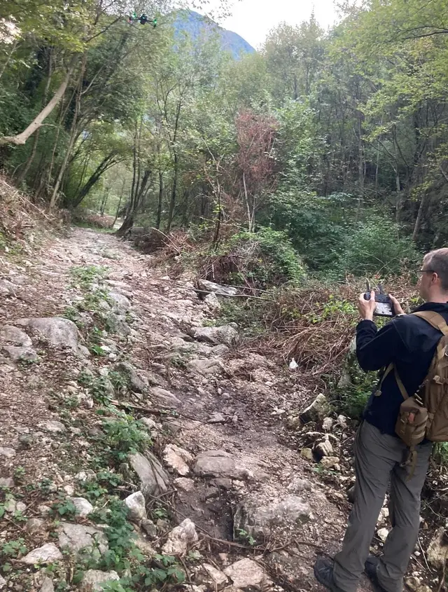
Maps of Roman roads are common in the study of antiquity. What identifies a route as Roman, however, is often less certain than such maps suggest. In the case of the wheel-rut roads (Geleisstraßen) in the Alps, for example, Swiss research on historical roads has shown that visible rut marks are frequently medieval or modern, and that the attribution “Roman” often rests solely on measurements that cannot be securely dated.
The project takes these forms of evidence as its starting point. New results from heritage authorities, historical societies and excavation firms are collected and related to terrain models derived from laser-scan data, aerial imagery and historical maps. In each case the question is what a single observation can actually support. An excavated road, a hollow way, a milestone, a bridge, a field name and a line on an old map each allow different conclusions about a route.
Road infrastructure. Beyond the road itself, the infrastructure belonging to a route comes into view. This includes bridges and fords, milestones and settlements. Funerary sites hold a special place: in Roman times they frequently lay along the arterial roads leading out of settlements and are therefore regarded as indicators of a nearby route.
Waterways. A transport network does not consist of roads alone. Alongside the seas, rivers formed the backbone of the movement of goods, and only a combined view of both systems allows reliable statements about it. Their courses have changed considerably since antiquity, and former channels and small streams have in part disappeared entirely. Historical maps such as the Urpositionsblätter and the Bavarian Urkataster show the watercourses before the river regulation of the nineteenth century and are thus the starting point for reconstructing earlier courses.
Research questions
- How can the transport network of Roman Bavaria be newly assessed on the basis of current data?
- Is it possible to make statements about the development of routes over time?
- Which routes beyond the main roads can plausibly be reconstructed?
- Which forms of evidence can support a route reconstruction and which cannot?
Material
- New excavation and find results from heritage authorities, historical societies and excavation companies
- Digital terrain models from laser-scan data (LiDAR) and aerial imagery
- Historical maps, including the Urpositionsblätter and the Bavarian Urkataster
- Road infrastructure such as bridges, fords, milestones and settlements
Aims
- Bringing together the scattered new information into a consistent overall picture
- Correlating the routes with terrain models and historical maps
- Gaining an updated picture of the Roman transport network in Bavaria
Persons

Prof. Dr.
Michael
Rathmann
Chair of Ancient History
Room: UA 117

Prof. Dr.
Nadin
Burkhardt
Professorship of Classical Archaeology
Building
Universitätsallee/Zentralbibliothek
|
Room: UA-248

Dr.
Christian
Beck
Transport Infrastructure Project Atrium
Adrian
Karmann
M.A.
Research Associate
Room: UA 130
Project Partners